Haxby
 Haxby is a town and civil parish in the City of York, a unitary authority area in the English county of North Yorkshire. The town of Haxby has a population of just under 9,000 people.
Open farmland extends to the north as far as the villages of Sutton-on-the-Forest and Strensall. The River Foss is to the east. It is located beyond the York Outer Ring Road and near the New Earswick and Huntington areas of York, to the south. It shares a continuous built-up area with the village and parish of Wigginton to the west.
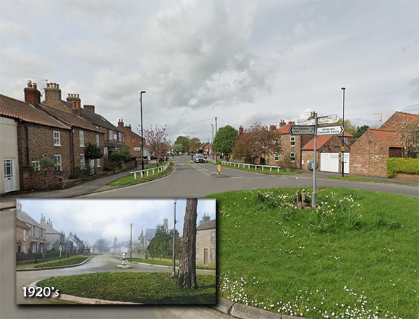
The town's name is of Old Norse origin with the personal name of Hákr's settlement, in Old Norse bý. It was recorded as Haxebi in the Domesday Book of 1086. Haxby Town Centre, known as "The Village", has been a Conservation Area since 1976.
A settlement on the site of the modern town named by the Vikings as Haxebi was established around the 9th century. The Norse word "by" meant a township or farm and was usually appended to the name of the holder of the lands, in this case a man called Hakr. A Grade III listed Viking cross base in the churchyard of St Mary's Church, and the discovery of a Viking cross shaft in a nearby garden in 1978 support this date. There is evidence of Roman occupation with the 1966 discovery of a site of a Roman villa on Haxby Moor. Roman pottery was found in 2003 on Station Road along with a silver Roman signet ring.
In the Middle Ages, because the village was in the royal Forest of Galtres, its inhabitants were subject to forest law and took part in the occasional courts that devised and enforced it. Charles I divested himself of the forest in 1629 and the village acquired the land to increase its size.
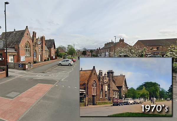
Much of the current town centre is 18th and early 19th century architecture but significant redevelopment took place in Victorian times of which the Memorial Hall (formerly the Board School), the present St Mary's Church and the Methodist Chapel are all important buildings. It was at this time, with the arrival of the railway in Haxby, that the village became a popular place to live and commute from. Growth continued gradually throughout the first half of the 20th century until the population explosion in the 1970s quadrupled the population. In 1976, the local authority took the very important step of designating the centre of Haxby as a conservation area.
By 1992, Haxby had outgrown its image of a rural village and was declared a town, by which time its population had grown to be over 10,000. In 1996, a national revision of boundaries moved Haxby from Ryedale District Council to be part of City of York Unitary Authority and this new authority adopted the boundaries and conditions of the conservation area.
Haxby has a Town Council, which is represented by 14 Councillors from four Wards (North, East, Central, and South West) which align with the four polling districts. The Town Council office is located at Haxby Memorial Hall.
You can click here for the Haxby Town Council website.